Log in
All resources
Create a design
38,013 Free Images of 1879 Maps
list of vanity fair (british magazine) caricatures (1875–1879)
maps in the library of congress
maps by joseph hutchins colton
1855 maps
caricatures by leslie ward in vanity fair
vanity fair caricatures (politicians)
a map of the british empire in america with the french and spanish settlements adjacent thereto
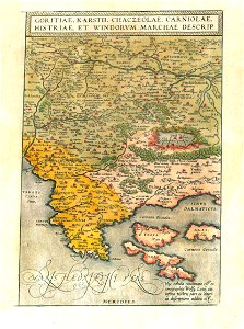
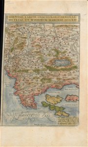
old maps of the balkans
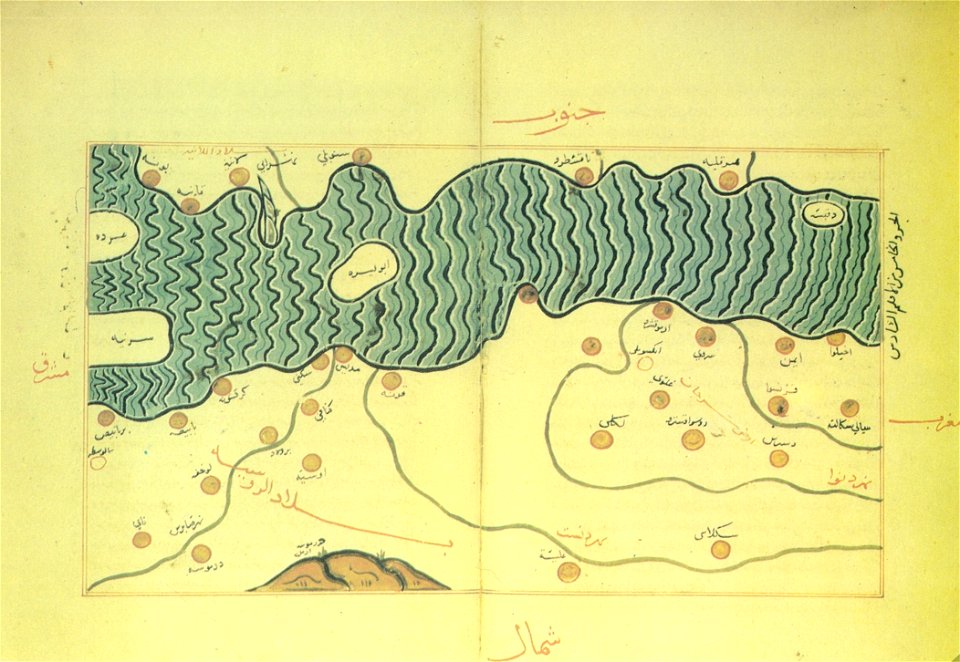
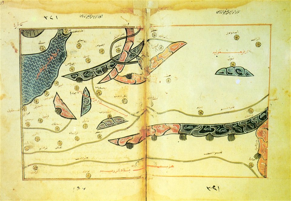
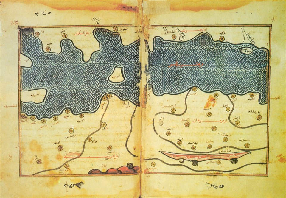
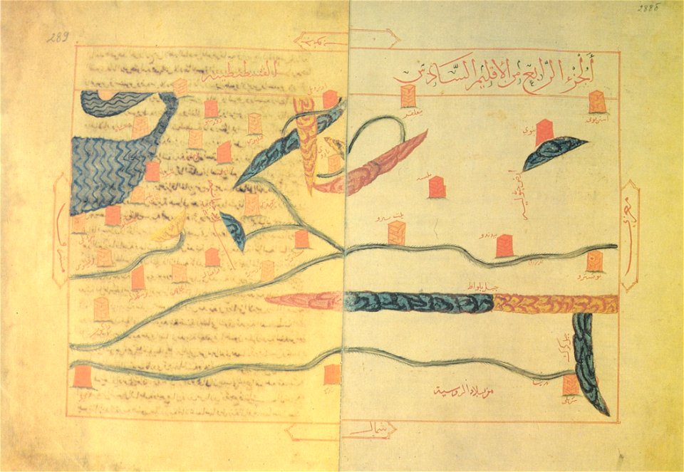
arabic-language maps
al-idrisi maps
old maps of the balkans
arabic-language maps
old maps of the balkans
arabic-language maps
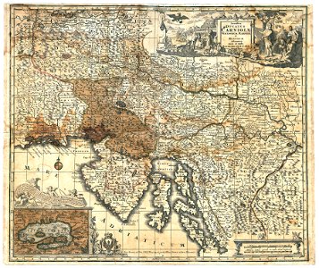
16th-century maps of slovenia
old maps of croatia
old maps of the balkans
arabic-language maps
old maps of the balkans
arabic-language maps
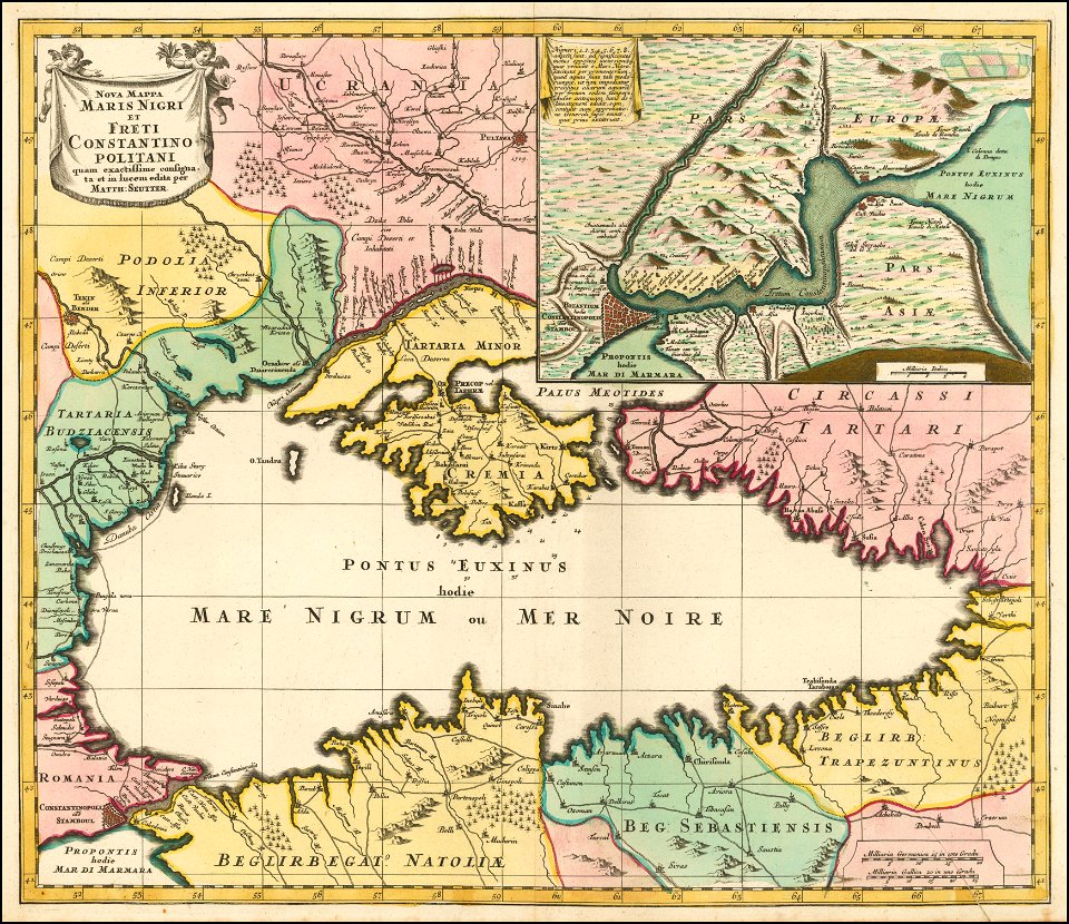
maps by matthäus seutter
1732 maps
16th-century maps of slovenia
maps by wolfgang lazius
16th-century maps of slovenia
maps by wolfgang lazius
latin-language maps
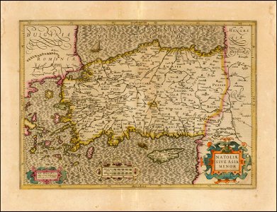
old maps of turkey
italian-language maps
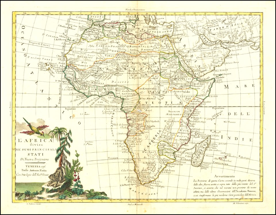
maps by antonio zatta
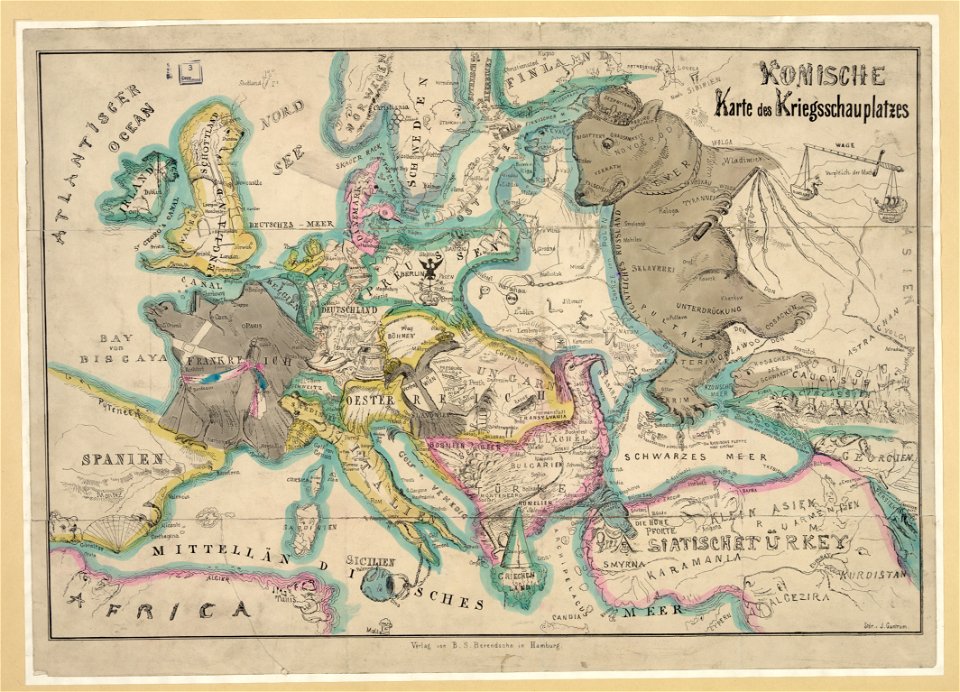
19th-century satirical maps
german-language maps
list of falconiformes by population
list of endemic birds of borneo
1886 deaths
1849 births
vanity fair caricatures (politicians)
3rd baronet
don quixote (part 1)
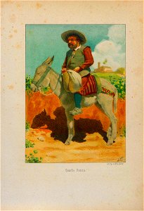
sancho panza
don quixote (part 1)
sancho panza
don quixote (part 1)
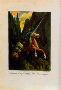
alonso quijano
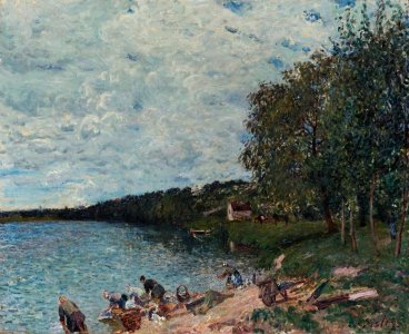
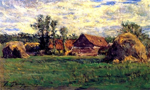
paintings of the seine by alfred sisley
1879 paintings by alfred sisley
list of vanity fair (british magazine) caricatures (1875–1879)
caricatures by leslie ward in vanity fair
vanity fair caricatures (politicians)
louis blanc
artworks of the united states in the cooper–hewitt
1879 works
caricatures by carlo pellegrini in vanity fair
vanity fair caricatures (politicians)
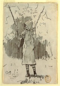
drawings of sitting males
1879 drawings
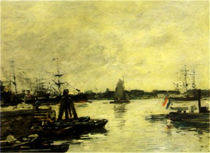
paintings by paul gauguin in private collections
1879 paintings
paintings by paul gauguin in private collections
1879 paintings
1870s paintings from france
1879 paintings
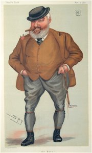
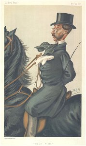
vanity fair caricatures (politicians)
william montagu
red in art
red stock
list of vanity fair (british magazine) caricatures (1875–1879)
men of the united kingdom in art
vanity fair caricatures (politicians)
jules grévy
printing
1862
list of vanity fair (british magazine) caricatures (1875–1879)
caricatures by leslie ward in vanity fair
vanity fair
1875,
1879 paintings
1862
paintings by james tissot
1870s paintings of people
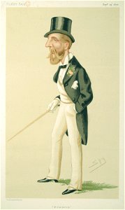
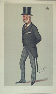
5th earl of rosebery
archibald primrose
vanity fair
1875,
list of vanity fair (british magazine) caricatures (1875–1879)
vanity fair caricatures (royalty)
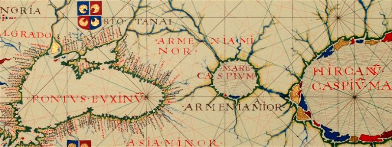
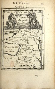
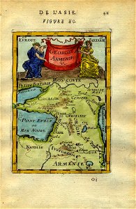
16th-century maps of the black sea
16th-century maps of georgia
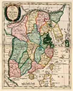
china in the 1700s
old maps of taiwan
17th-century maps of china
old maps of korea
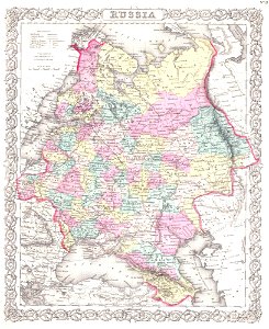
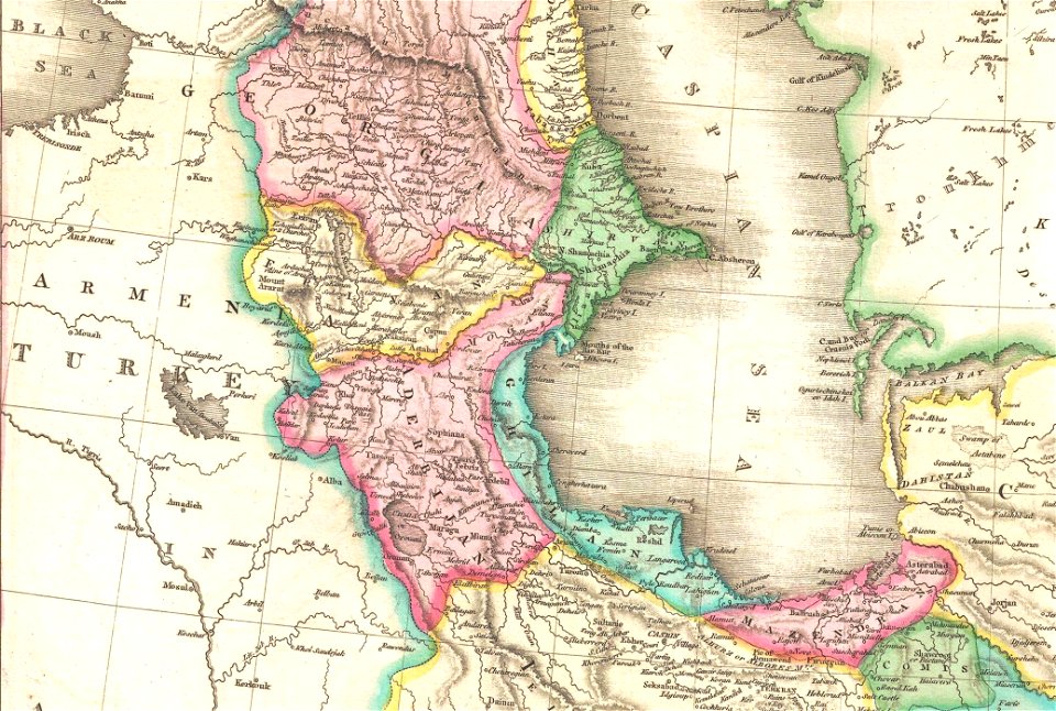
19th-century maps of the caucasus
old maps of the russian empire
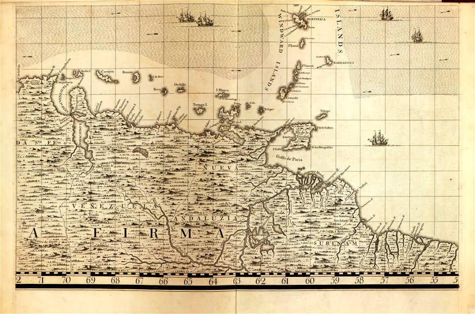
a map of the british empire in america with the french and spanish settlements adjacent thereto
maps in the library of congress
a map of the british empire in america with the french and spanish settlements adjacent thereto
maps in the library of congress
maps in the library of congress
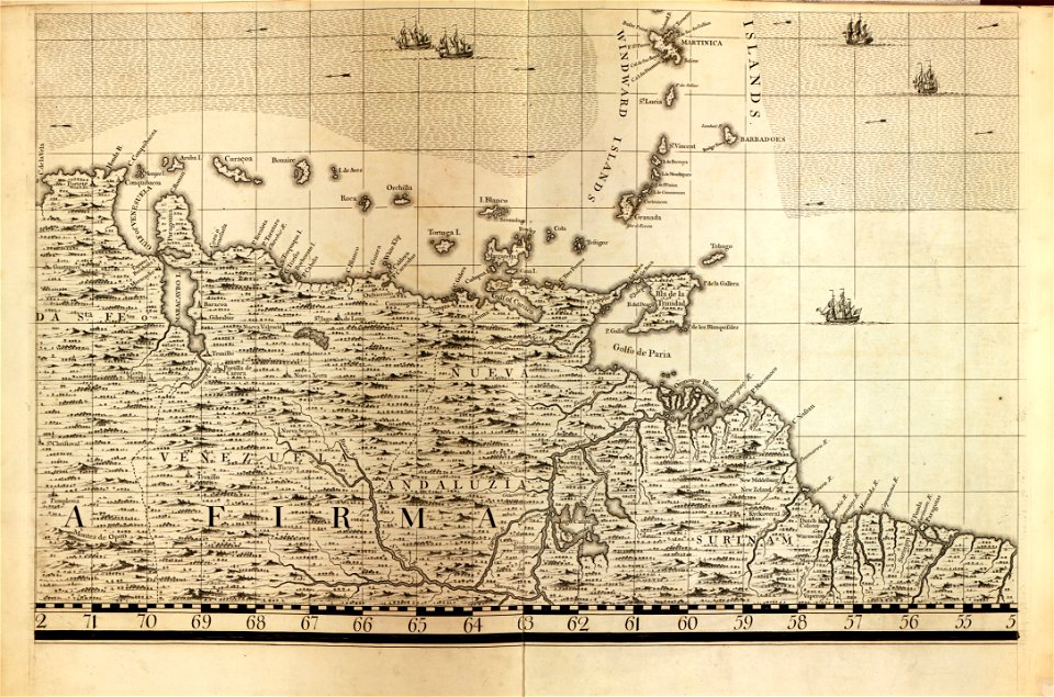
18th-century maps of barbados
maps in the library of congress
18th-century maps of barbados
maps in the library of congress
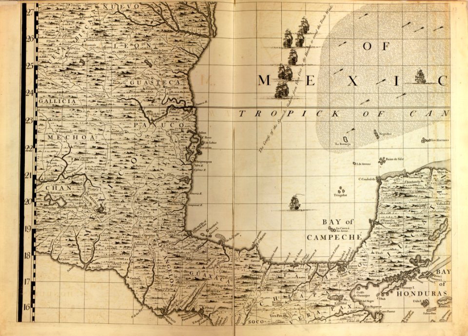
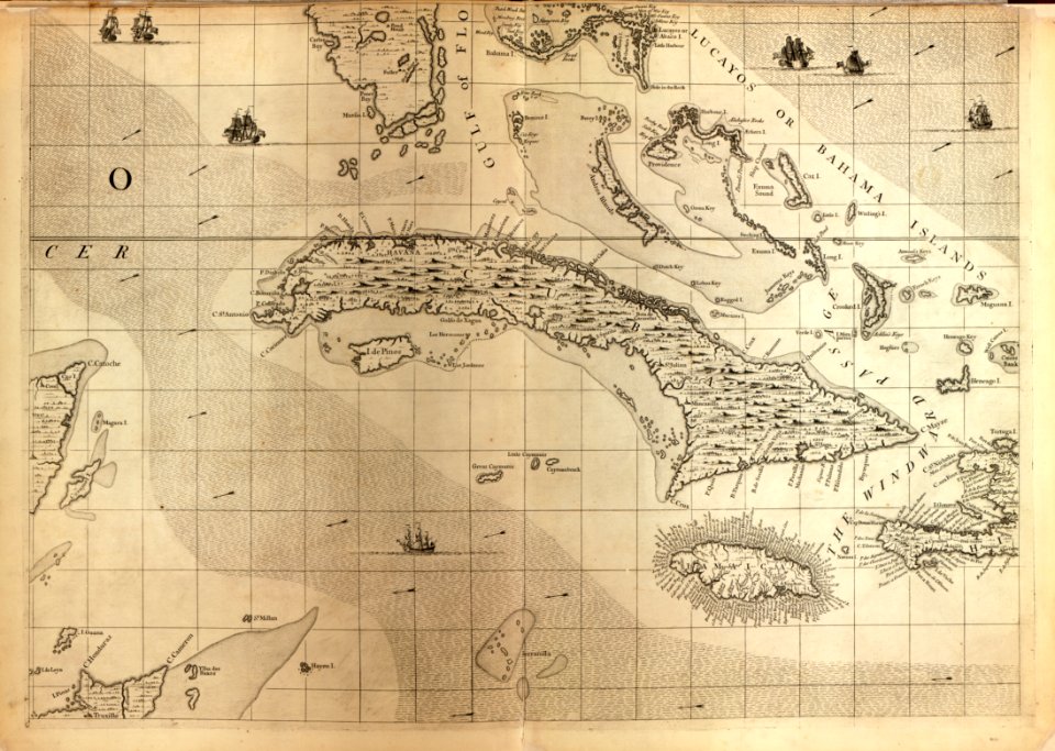
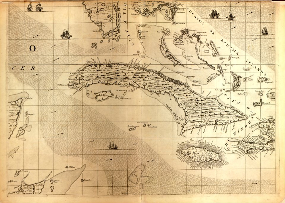
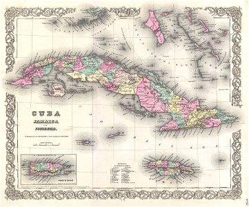
18th-century maps of cuba
maps in the library of congress
18th-century maps of cuba
maps with figures
frans hogenberg
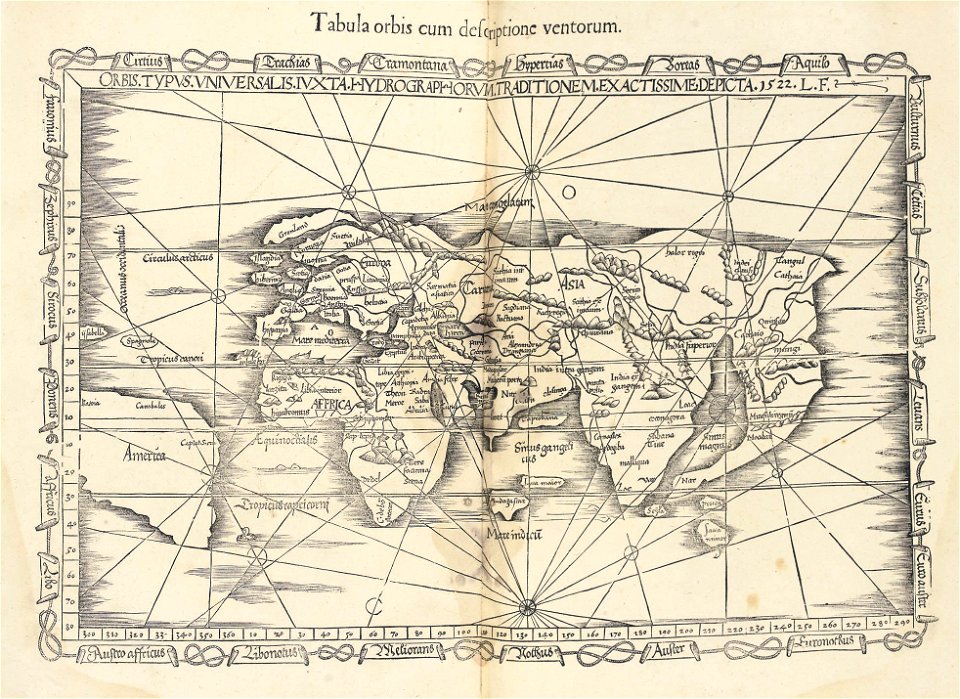
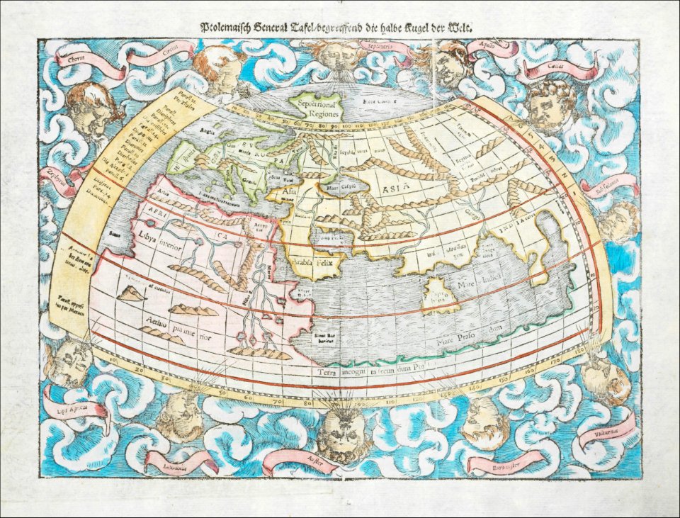
ptolemaic world maps
latin-language maps
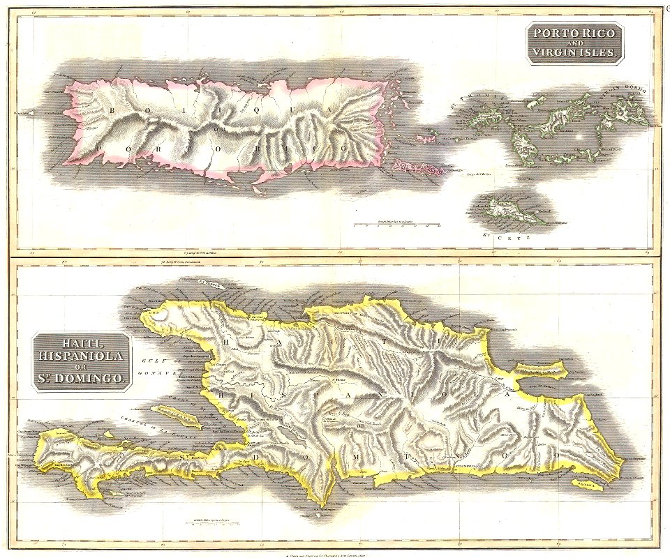
old maps of jamaica
colonial cuba
old maps of the russian empire
1855 maps
maps of native american tribal territories
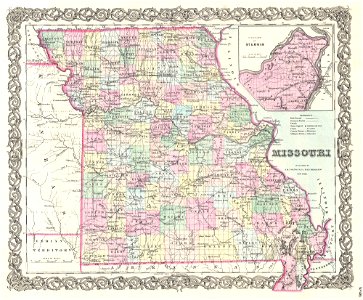
old maps of missouri
old maps of the middle east
1855 maps
maps of traditional counties of scotland
old maps of scotland
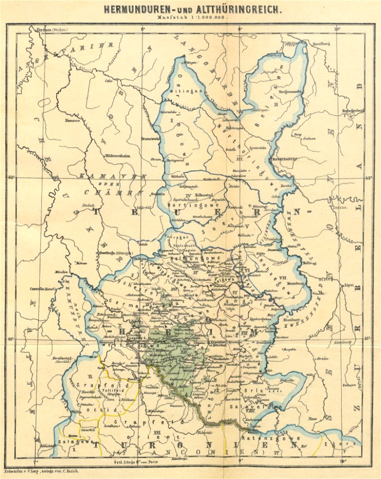
maps of the frankish territory
1892 maps
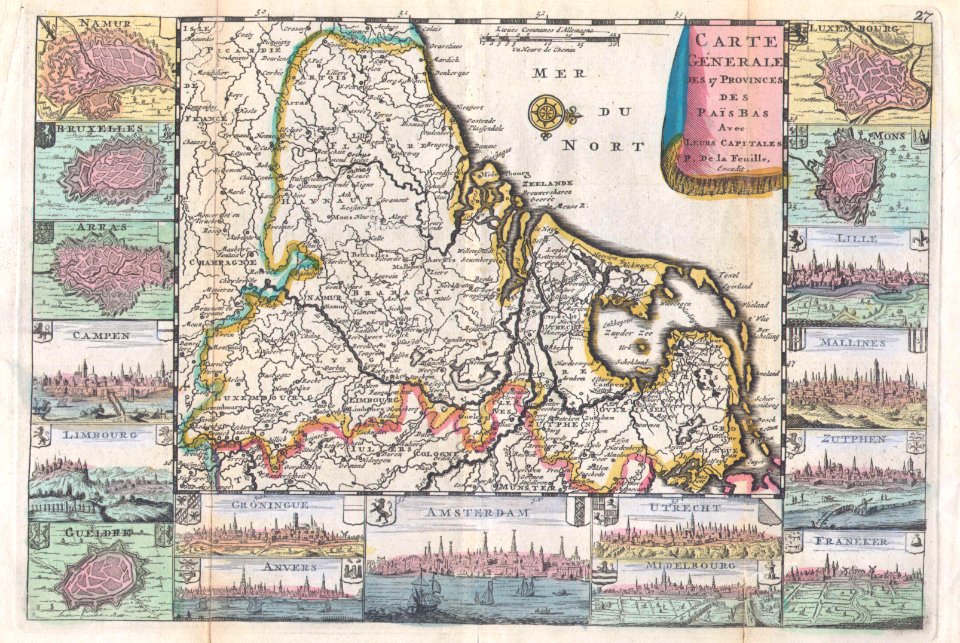
maps by willem and johannes blaeu
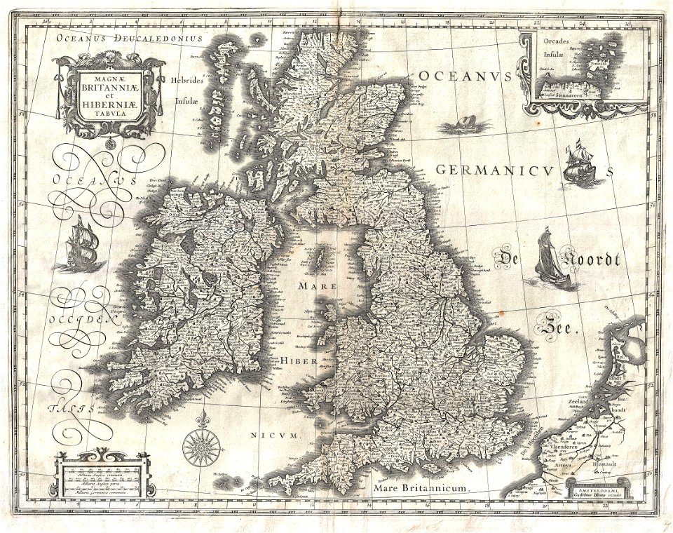
old maps of the british isles
18th-century maps of the black sea
maps by matthäus seutter
maps by sebastian münster
ptolemaic world maps
italian-language maps
1776 maps
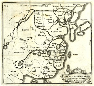
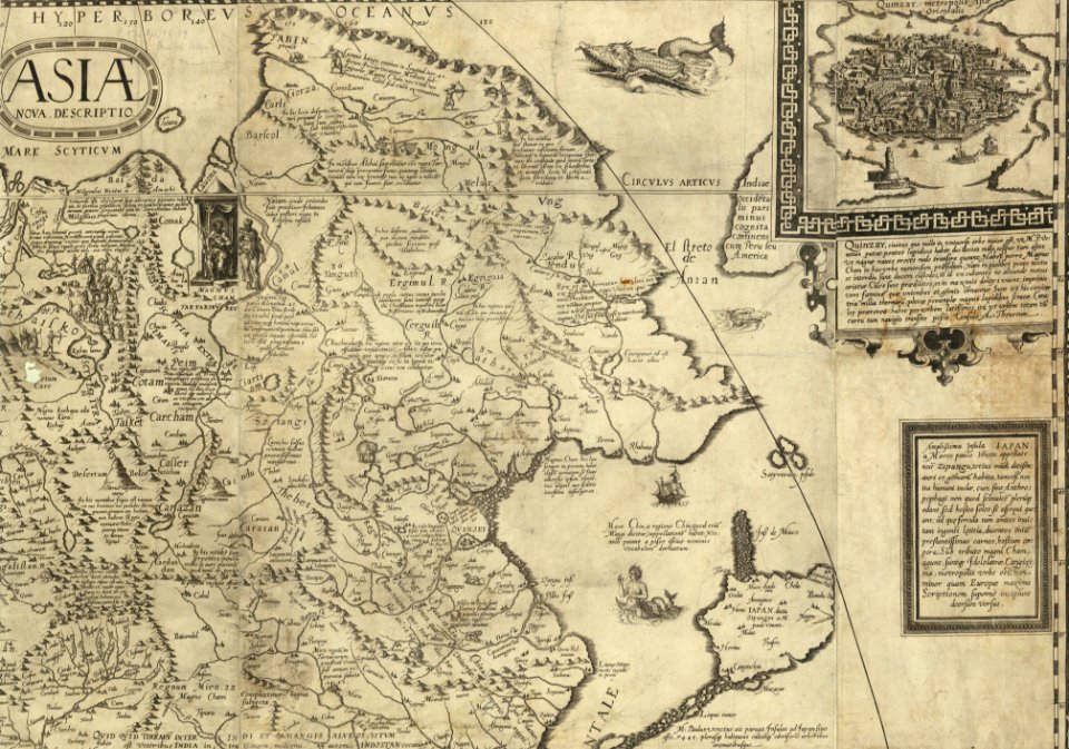
old maps of china
old maps of asia
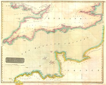
maps by john thomson
1814 maps
old maps of greece
1896 maps
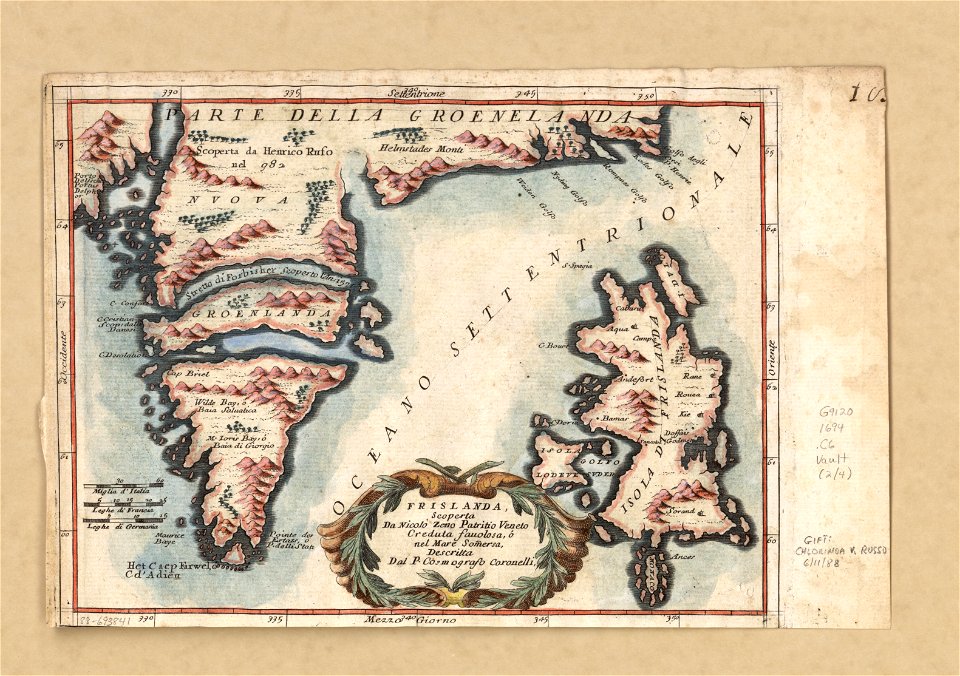
old maps of greenland
coats of arms on maps
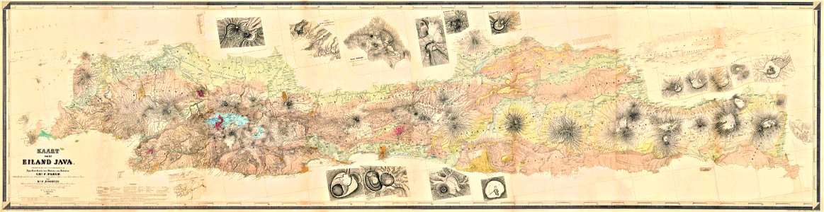
maps by franz wilhelm junghuhn
old maps of java
south dakota
iowa
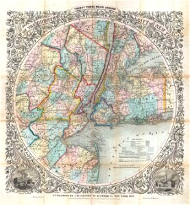
cartography of new york city
english-language maps
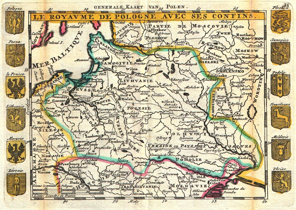
old maps of poland
johannes ratelband
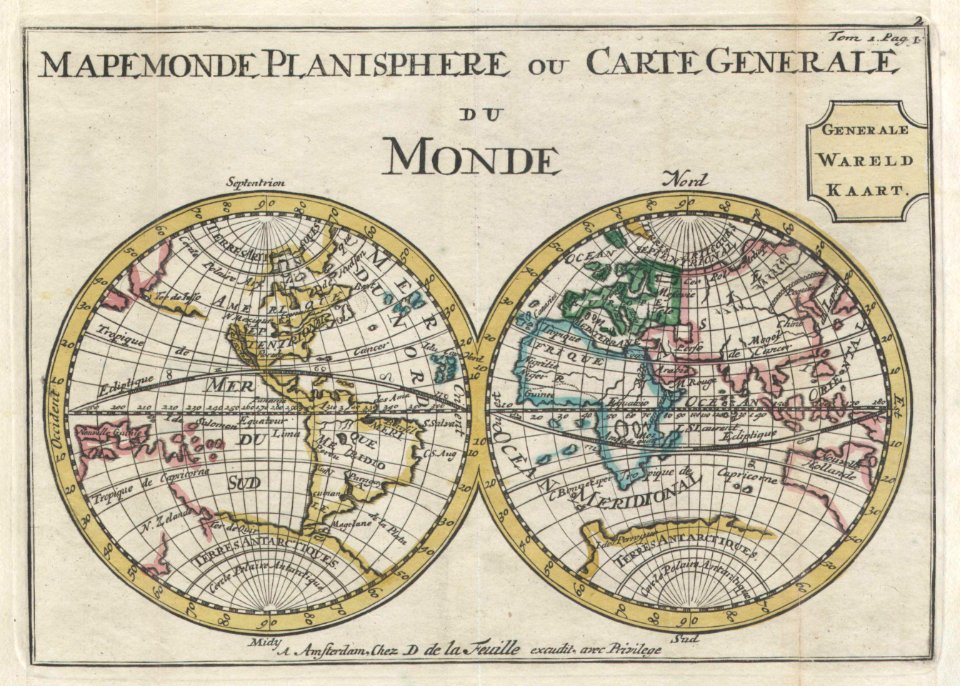
old maps of earth's hemispheres
double hemisphere world maps
french-language maps
1710 maps
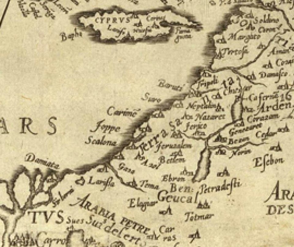
16th century maps of the middle east
1590 maps of israel
1590 maps of armenia
1590 maps of turkey
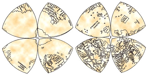
reuleaux triangles
world map
maps with cartouches
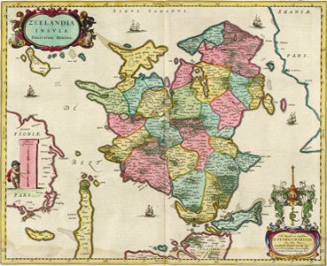
joan blaeu
old maps of suriname
old maps of guyana
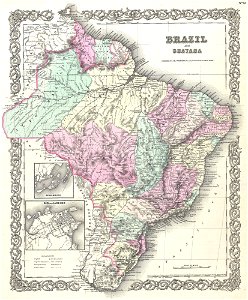
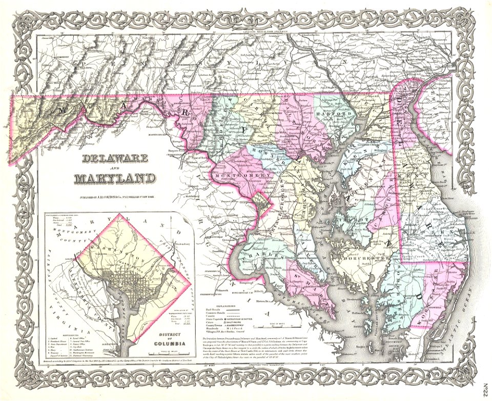
virginia
d.c.,
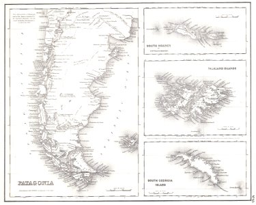
old maps of the falkland islands
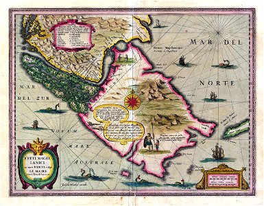
old maps of patagonia
17th-century maps of georgia
old maps of turkey
ships on maps
1628 maps
17th-century maps of georgia
old maps of turkey
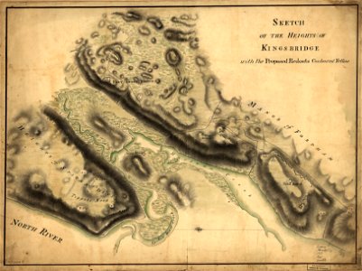
new york city
bronx
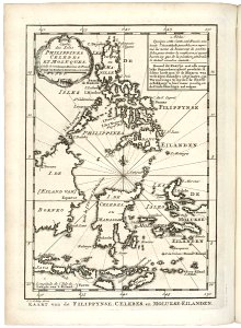
18th-century maps of indonesia
old maps of the philippines
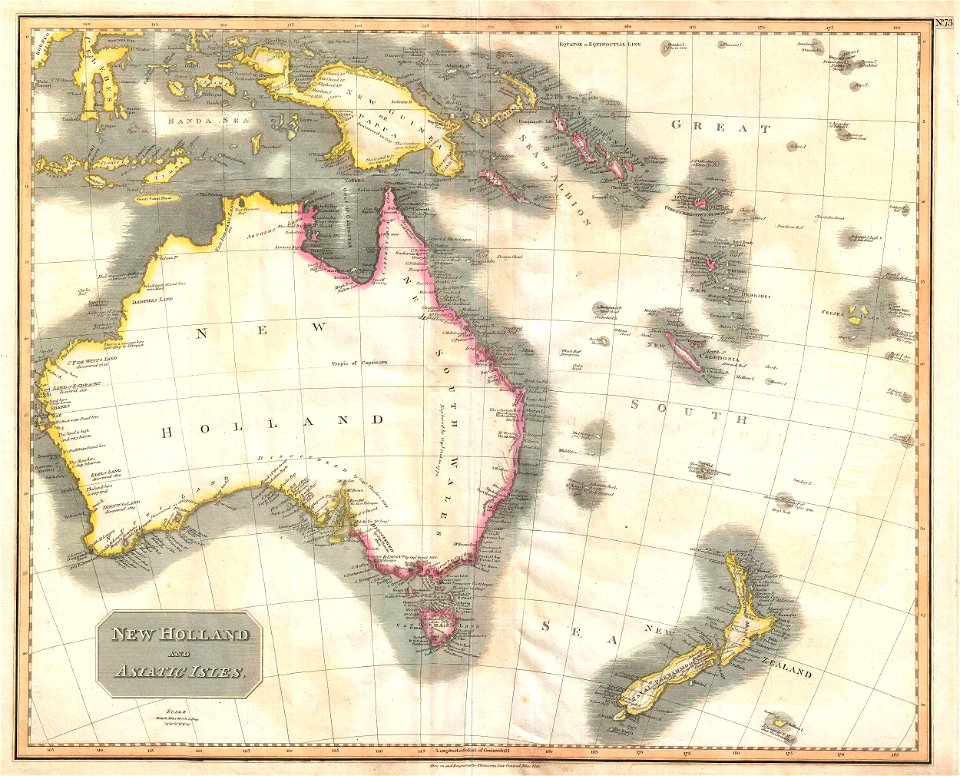
old maps of the history of oceania
english-language maps
english-language maps
maps by john thomson
new york city
bronx
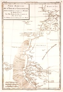
historical maps of western sahara
dien (printer)
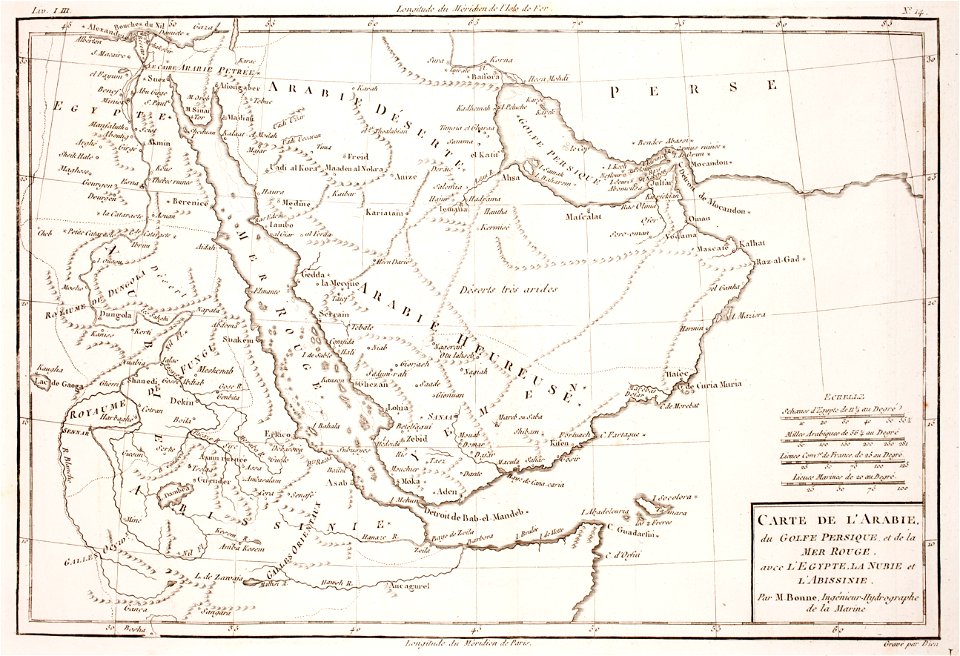
1780 maps of eritrea
1780 maps of egypt
old maps of the middle east
harvard university
pieter van der keere
sindi people
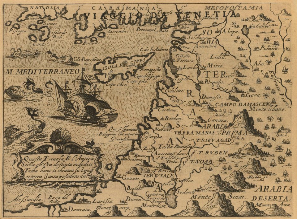
old maps of the middle east
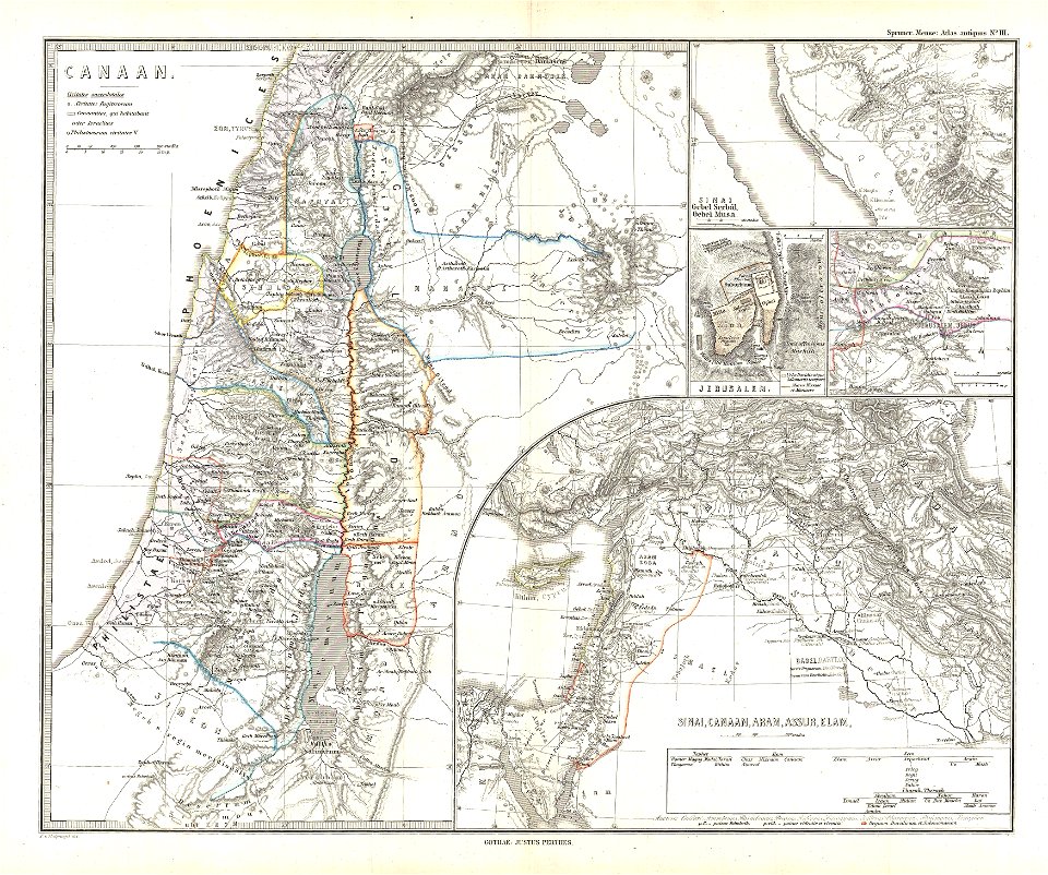
maps of canaan
old maps of greece
old maps of crete
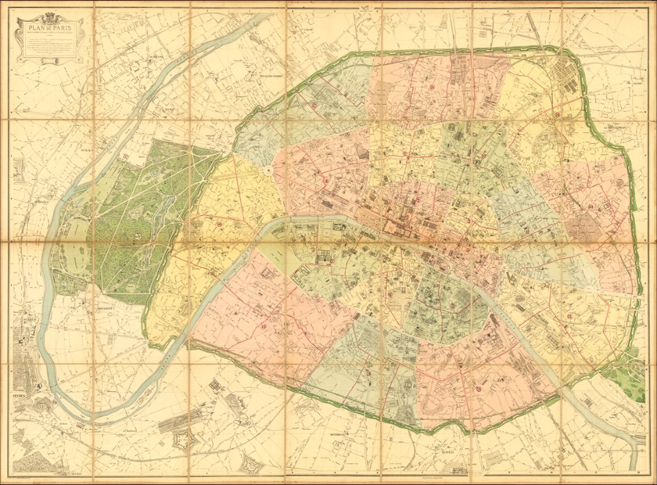
1870s maps of paris
1870 maps
maps of okinawa islands
maps of guam
19th-century maps of the caucasus
english-language maps
maps in the library of congress
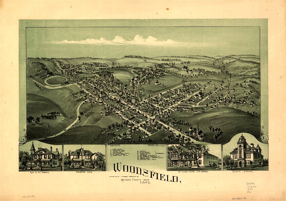
ohio
maps in the library of congress
ohio
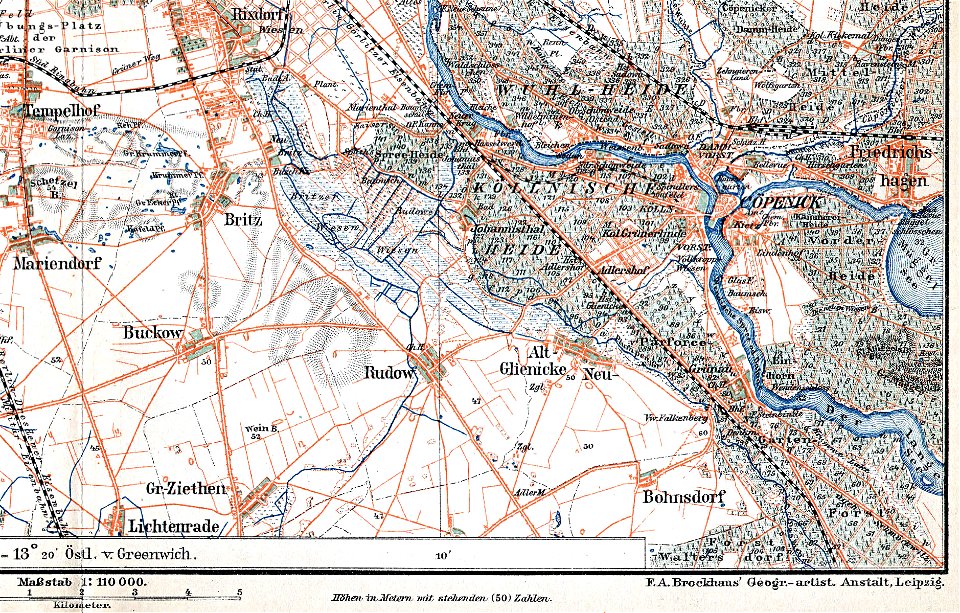
parts of old maps of berlin
maps by brockhaus
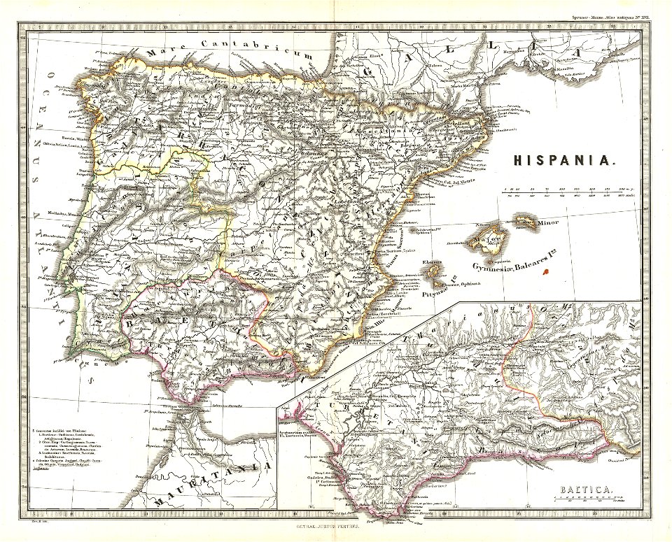
old maps of the iberian peninsula
1865 maps
old maps of the persian gulf
1616 maps
maps by willem and johannes blaeu
coats of arms on maps
1701 - 1800 of 38,013
Next page
/ 381